
What Is Outdooractive?
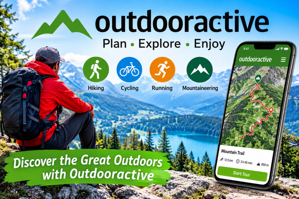
Outdooractive is a digital outdoor platform designed to help people discover new places, explore nature, and plan outdoor adventures. It brings together maps, route information, navigation features, and travel inspiration in one convenient place.
Whether someone enjoys hiking through mountain landscapes, cycling along quiet country roads, walking through forests, or exploring unfamiliar destinations, Outdooractive offers tools that can make planning an outdoor experience easier.
The platform is particularly useful for people who want to prepare before leaving home. Instead of relying entirely on recommendations from friends or searching through different websites, users can explore routes and review useful information in one place.
Outdooractive also connects people with destinations and outdoor experiences. Its route information can help users understand where a trail begins, how long an adventure might take, and what type of landscape they can expect to encounter.
One of the most interesting aspects of Outdooractive is its focus on making outdoor exploration accessible to different experience levels. Beginners can look for straightforward walking routes, while experienced outdoor enthusiasts can investigate more demanding adventures.
The platform is not simply about finding a destination. It is also about understanding the journey, preparing appropriately, and making outdoor experiences more enjoyable.
How Does Outdooractive Work?
Outdooractive works by combining digital maps, outdoor route information, and planning tools. Users can explore available routes, choose an activity, examine the details, and prepare an adventure that matches their interests.
The process usually begins with selecting a destination or searching for an activity. Users can browse hiking trails, cycling routes, walking paths, and other outdoor experiences.
After finding an interesting route, they can review its available information. Depending on the route, this may include distance, estimated duration, elevation gain, difficulty, terrain, photographs, and nearby attractions.
The route planner is another important part of the experience. It allows users to create their own routes instead of depending entirely on existing suggestions.
Outdooractive also supports navigation and route tracking. Users can follow a planned journey and monitor their progress while exploring.
The platform offers additional features through its subscription options. Some advanced maps and offline tools require a paid plan, so checking the current subscription details is important before choosing a package. Apps on Google Play+2
The Main Features of Outdooractive
Outdooractive includes several features that support outdoor planning and exploration. Each feature serves a different purpose, making the platform useful for different activities.
Route Discovery and Exploration
Finding an interesting route is often the first step toward planning an outdoor adventure. Outdooractive helps users discover routes by browsing destinations and exploring available activities.
Users can look for trails in familiar locations or investigate places they have never visited. This makes it easier to discover new walking paths, mountain routes, cycling trails, and scenic locations.
Route descriptions can provide helpful information about the experience. Photographs and descriptions may also help users understand the landscape before deciding whether a particular journey is suitable.
Another advantage is the variety of outdoor activities supported by the platform. Rather than focusing exclusively on hiking, Outdooractive also serves cyclists, runners, walkers, and other outdoor enthusiasts.
Detailed Outdoor Maps
Maps are among the most important elements of any navigation platform. Outdooractive provides access to different map types that help users understand the geography of an area.
Topographic maps are particularly useful because they show landscape features, elevation changes, and geographical details. These features can help people understand whether a route passes through flat countryside, wooded areas, or mountainous terrain.
The available map collection depends on the country and subscription. Official mapping options are available for various regions, while additional specialist maps may be included in higher subscription packages. Apps on Google Play+1
Route Planning Tools
Outdooractive is useful for people who prefer creating their own adventures.
Its route planner allows users to build a route by selecting points on a map. Automatic routing can help connect those points with suitable paths from the available trail network.
This is helpful when someone wants a journey that starts and finishes at a particular location.
For example, a person might want a circular walking route that begins near a village, passes through a forest, and returns to the starting point.
The planner can also provide useful route information, including distance and elevation details. This allows users to consider the overall difficulty before setting out.
GPS Navigation and Tracking
Navigation is another important feature of Outdooractive.
GPS technology helps users understand their current position and follow a planned route. It can make unfamiliar outdoor locations easier to explore.
Route tracking can also help users record their outdoor activities. Depending on the available features, recorded tracks can include information about the journey and associated photographs.
However, digital navigation should always be treated as a supporting tool. Users should remain aware of their surroundings and follow local signs and official instructions.
Offline Maps and Route Downloads
Mobile reception is not guaranteed in every outdoor location. Remote forests, mountain valleys, and rural areas can have limited connectivity.
Outdooractive offers offline storage options that allow users to download selected routes or map areas before travelling.
This can be particularly helpful when an internet connection is unavailable during an adventure.
The important point is to prepare beforehand. Users should check that their required maps and routes have downloaded successfully and that their device has sufficient battery power.
Offline availability and download limits depend on the subscription. Apps on Google Play+1
Mobile App Development | Chat Bots Development | A-bots
Elevation Profiles and Terrain Information
Distance is not the only factor that determines how challenging an outdoor route will be.
A short trail with significant elevation gain may require more effort than a longer route through flat countryside.
Outdooractive provides elevation and terrain information for many routes. These details help users understand what to expect before starting.
Elevation profiles can show where a route climbs, descends, or follows relatively level ground.
This information is especially valuable when planning mountain walks, cycling adventures, and longer outdoor journeys.
Community and Shared Experiences
Outdoor activities are often more enjoyable when people can exchange experiences and recommendations.
Outdooractive includes community-oriented features that allow users to share routes, photographs, and information.
These contributions can provide inspiration when someone is searching for a new destination.
However, community information should be evaluated carefully. A route description uploaded by another user may not reflect current conditions.
It is always sensible to compare shared information with official local guidance.
Outdooractive for Hiking Enthusiasts
Hiking is one of the main activities associated with Outdooractive.
The platform helps hikers discover trails, examine route information, and prepare for journeys in different landscapes.
A beginner might prefer a short walking trail with gentle slopes and clear descriptions. Someone with more experience may look for a longer mountain adventure with greater elevation changes.
Outdooractive makes it possible to investigate these differences before choosing a route.
Finding Hiking Trails
Users can search for hiking opportunities in a selected destination or browse the map to discover nearby routes.
Available route descriptions may include estimated walking times, distances, elevation changes, and photographs.
These details help people make more informed decisions.
It is also useful to check whether a route is officially maintained and whether any temporary restrictions apply.
Planning Mountain Walks
Mountain walks require more preparation than ordinary urban walks.
Weather, terrain, daylight, and personal experience can all affect the overall journey.
Outdooractive can help with the planning stage by presenting maps and route information.
Hikers should still check local weather forecasts, official trail notices, and any relevant safety information before leaving.
Discovering Scenic Locations
A hiking route is often about more than reaching a particular destination.
Many people enjoy discovering lakes, forests, viewpoints, waterfalls, and traditional villages along the way.
Outdooractive route descriptions and destination information can help users discover these interesting locations.
This makes the platform useful for people who enjoy combining walking with sightseeing and photography.
Outdooractive for Cycling and Mountain Biking
Cycling requires different route information from hiking.
Road cyclists may prefer smooth roads, quieter routes, and longer distances. Mountain bikers may be interested in off-road trails, elevation changes, and technical terrain.
Outdooractive supports different cycling activities, helping users search for routes that match their preferences.
Road Cycling Routes
Road cycling routes can vary considerably in distance and difficulty.
Some follow relatively flat countryside roads, while others include challenging climbs and winding mountain sections.
Outdooractive can help cyclists review available routes and examine their general characteristics before choosing one.
Users should always check road conditions, traffic rules, and local cycling restrictions.
Mountain Biking Adventures
Mountain biking is another activity supported by the platform.
Riders can investigate trails and review available information about terrain and elevation.
Choosing a suitable route is especially important because off-road trails can differ significantly in difficulty.
Cyclists should select trails appropriate to their experience and follow designated access rules.
Discovering New Cycling Destinations
Exploring a new cycling destination can be exciting, but it requires preparation.
Outdooractive can help users investigate routes, identify interesting locations, and organize their journey.
It may also be useful when planning a cycling holiday because users can explore different destinations before making travel arrangements.
About Tignes summer lift pass prices
Outdooractive for Walking, Running, and Other Activities
Outdooractive is not limited to hikers and cyclists.
The platform supports a broader selection of outdoor activities, making it relevant to people with different interests.
Walking and Nature Exploration
Walking is one of the simplest ways to enjoy the outdoors.
Some people prefer peaceful woodland paths, while others enjoy countryside walks and sightseeing routes.
Outdooractive can help users discover walking opportunities and review available route information.
Its maps and descriptions can make it easier to prepare for an unfamiliar location.
Trail Running
Trail running combines physical activity with natural landscapes.
Unlike ordinary road running, trail running often involves uneven ground, changing elevations, and natural obstacles.
Outdooractive supports trail-running route discovery and planning.
Runners should choose suitable paths and consider the terrain and weather before beginning a journey.
Ski Touring and Winter Activities
Outdooractive also includes winter-related outdoor activities.
Depending on the destination and available information, users may discover ski touring routes and other seasonal experiences.
Winter conditions can change quickly, so digital route information should never replace local weather reports, official warnings, and appropriate professional advice.
Outdooractive Basic, PRO, and PRO+ Explained
Outdooractive provides different subscription options.
The available features can vary by plan, country, and current product offering. Users should consult the official pricing page before purchasing.
The following table provides a general overview of the subscription structure.
| Feature | Basic | PRO | PRO+ |
|---|---|---|---|
| Browse outdoor routes | Yes | Yes | Yes |
| Global outdoor maps | Yes | Yes | Yes |
| Additional official maps | Limited | Included options | Expanded options |
| Offline map access | Limited | Expanded | Expanded |
| Specialist map collections | Limited | Selected options | Additional options |
| Advanced planning tools | Varies | Included options | Included options |
Outdooractive (UK)+1
Outdooractive Basic
The Basic option provides an introduction to the platform.
It allows users to explore available outdoor content and discover routes without immediately purchasing a subscription.
This can be a suitable starting point for people who want to understand the platform before deciding whether advanced features are necessary.
Outdooractive PRO
PRO is designed for users who want additional mapping and planning capabilities.
Depending on the current offering, it can provide access to official topographic maps and expanded offline functionality.
It may be particularly useful for people who regularly explore different destinations.
Outdooractive PRO+
PRO+ provides additional mapping options and specialist content beyond the basic offering.
It may appeal to people who need access to more detailed maps for specific outdoor activities.
The best subscription depends on how frequently someone uses Outdooractive and which features are important to their adventures.
How to Get Started With Outdooractive
Getting started with Outdooractive is relatively straightforward.
The platform is available through its website and mobile application. Users can explore the available options and choose the version that suits their needs.
Visit the Official Website
Start by visiting the official Outdooractive website.
The website provides access to route discovery, destination information, and outdoor planning features.
You can explore the platform before deciding whether you want to use its mobile application.
Create an Account
An account can provide access to personal features and help organize saved content.
Follow the registration instructions shown on the official platform.
Always use a strong password and protect your account information.
Explore the Map
After opening the map, select a destination or search for a location.
You can investigate available routes and identify interesting outdoor opportunities.
Try exploring different map layers to understand the geographical features of the area.
Select an Activity
Choose the activity that matches your plans.
For example, you might search for hiking trails, cycling routes, walking paths, or running opportunities.
The available results can help you compare different journeys.
Review the Route Details
Before selecting a route, examine its description.
Pay attention to distance, elevation, estimated duration, difficulty, and terrain.
Consider whether the route is suitable for your experience and the time available.
Save Your Plans
Once you find a suitable route, save it to your account or device using the available options.
If you plan to travel somewhere with limited reception, check whether offline downloads are available with your subscription.
Prepare Before Leaving
Planning should continue after selecting a route.
Check the weather, prepare suitable equipment, carry enough water, and tell someone about your plans when appropriate.
Outdooractive can support your preparation, but it cannot replace responsible decision-making.
Benefits of Using Outdooractive
Outdooractive offers several advantages for people who enjoy spending time outside.
Its main strength is the combination of route discovery, mapping, planning, and navigation.
Convenient Route Planning
Planning an outdoor journey can involve checking several websites and comparing different sources.
Outdooractive brings many useful planning features together.
Users can explore routes, examine their characteristics, and save suitable options.
This can reduce the time spent preparing and make it easier to organize an adventure.
Better Understanding of Destinations
Visiting an unfamiliar location can be challenging without reliable geographical information.
Maps, photographs, and route descriptions provide a better understanding of the destination.
They can help users identify interesting places and understand the general character of a route.
Support for Different Experience Levels
Outdooractive serves people with different outdoor interests and experience levels.
Beginners can investigate straightforward walking routes, while experienced outdoor enthusiasts can explore more demanding journeys.
The important thing is to select activities that match individual abilities.
Useful Offline Preparation
Offline map downloads can be valuable in areas where mobile coverage is limited.
Users can prepare their selected routes before travelling.
This provides another way to access important navigation information when a reliable internet connection is unavailable.
A Wide Range of Outdoor Activities
Another advantage is the variety of activities supported.
Users can explore hiking, cycling, walking, running, and other outdoor experiences through one platform.
This makes Outdooractive useful for people whose interests change throughout the year.
Inspiration for Future Adventures
Sometimes people want to explore nature but do not know where to begin.
Outdooractive can provide inspiration through route collections, destination information, and community contributions.
Discovering an unfamiliar location can encourage people to try new activities and enjoy different landscapes.
Outdooractive Maps: Why They Matter
A good outdoor map provides much more than a simple picture of roads and paths.
It helps users understand the surrounding environment and make informed decisions about their journey.
Outdooractive offers different mapping options for this purpose.
Topographic Maps
Topographic maps display geographical information such as elevation, terrain, and landscape features.
They can be especially useful when exploring mountainous destinations.
Understanding elevation changes can help users estimate the effort required for a journey.
Official Regional Maps
Outdooractive provides access to official topographic maps from several countries through its mapping options.
These maps can contain valuable local information.
For example, its official app listing identifies mapping sources such as Ordnance Survey, USGS, Swisstopo, and IGN. Apps on Google Play+1
Specialized Maps
Some outdoor activities benefit from specialized maps.
A map designed for hiking may display different details from one intended for winter activities or climbing.
Specialist mapping options can therefore be useful when planning activities in particular environments.
Understanding Map Layers
Map layers allow users to view different types of geographical information.
Switching between available layers can provide a clearer picture of an area.
For example, one layer may make terrain features easier to understand, while another may provide more useful information about trails and geographical details.
Build your own community | Outdooractive Business
Outdooractive Route Planner: A Closer Look
The route planner is one of the platform’s most practical features.
It gives users an opportunity to create personalized journeys instead of relying exclusively on routes published by other people.
Creating a Personalized Route
A personalized route can be useful when someone has a specific starting point or destination in mind.
Users can select points on the map and connect them to build a journey.
Automatic routing can help follow available paths and trail networks.
The exact planning options depend on the selected activity and the available mapping information.
Understanding Distance and Elevation
Distance and elevation are important when evaluating a route.
A longer route is not necessarily more difficult than a shorter one.
A relatively short mountain trail may require considerable effort because of steep climbs and uneven terrain.
Reviewing these details helps users make more realistic plans.
Adjusting the Route
Sometimes an initial route does not match the intended journey.
A user may want to avoid a particular section, visit an additional destination, or choose a different starting point.
The route planner can help adjust the journey using the available editing tools.
This flexibility is useful when planning group outings and personalized adventures.
Saving and Sharing Routes
Once a route has been created, users may be able to save it and share it using the available platform features.
Sharing can help friends and family understand the proposed journey.
However, a shared route should not automatically be treated as proof that a trail is open or safe.
Always check current local conditions before following it.
Outdooractive Navigation and GPS Tracking
Navigation is an important part of exploring unfamiliar places.
Outdooractive combines route information with GPS-based positioning to help users follow planned journeys.
Following a Planned Route
After choosing a route, users can access the available navigation features.
GPS positioning helps indicate their current location in relation to the planned journey.
This can be particularly useful when exploring a large forest, unfamiliar countryside, or a destination with several connecting trails.
Recording Outdoor Activities
Outdooractive also provides activity-tracking features.
Depending on the selected tools, users can record their journeys and review information about completed activities.
This can help people keep track of their outdoor experiences and remember destinations they have visited.
Understanding GPS Limitations
GPS navigation is useful, but it is not perfect.
Position accuracy can vary because of terrain, buildings, weather conditions, and other environmental factors.
Users should never depend entirely on a smartphone when exploring unfamiliar or remote locations.
Traditional navigation skills and appropriate preparation remain important.
Sharing Your Location
Outdooractive has also offered a location-sharing feature called BuddyBeacon.
This feature is designed to help users share location information with selected people.
Availability and subscription requirements should be checked in the current app because features can change over time. App Store+1
https://developers.outdooractive.com/?utm_source=chatgpt.com
Outdooractive Offline Maps: Exploring Without Internet
One of the biggest concerns when visiting remote locations is losing internet connectivity.
Some outdoor destinations have limited mobile coverage, particularly in mountain valleys and isolated forests.
Outdooractive addresses this issue through offline map and route storage options.
Why Offline Maps Are Important
Offline maps provide access to previously downloaded geographical information.
This can help users continue viewing their planned routes when a mobile connection is unavailable.
It also reduces the need to depend on mobile data throughout an outdoor journey.
Preparing Maps Before Travelling
Preparation is essential.
Users should open the selected route or map area while they have a reliable internet connection.
They should then use the available download option and confirm that the required content has been saved.
It is sensible to check the downloaded material before travelling rather than assuming that everything is available offline.
Offline Navigation Considerations
Offline navigation still depends on the information stored on the device and the availability of GPS positioning.
It does not mean that every feature will work without an internet connection.
Some live information, synchronization functions, and online content may remain unavailable.
Users should understand these limitations before relying on offline functionality.
Outdooractive for Travel and Tourism
Outdooractive is also relevant to tourism destinations and travel organizations.
It is not only a consumer navigation application. The wider platform includes tools that help tourism providers organize and publish information about their destinations.
This creates a connection between outdoor visitors and the organizations responsible for promoting local experiences.
Discovering Tourist Attractions
People visiting a new destination often want to discover more than its most famous attractions.
They may also be interested in local walking trails, natural viewpoints, cycling routes, cultural locations, and outdoor activities.
Outdooractive can bring different types of destination information together.
Exploring Local Experiences
Local experiences can make a holiday more interesting.
A visitor might discover a countryside walk, a scenic cycling route, or an attractive location outside the main tourist area.
Route descriptions and destination information can help travelers understand what is available.
Supporting Tourism Organizations
Outdooractive Business provides digital tools for tourism destinations and service providers.
These tools support destination information management, digital travel guides, visitor guidance, and content distribution.
The company describes its platform as a central system for managing tourism information and connecting visitors with destination content. business.outdooractive.com+1
Encouraging Responsible Tourism
Outdoor recreation should benefit both visitors and the places they explore.
Responsible tourism involves respecting local communities, following designated paths, and avoiding unnecessary damage to natural environments.
Digital destination information can help visitors discover appropriate activities and understand local guidance.
However, responsible travel ultimately depends on the choices made by individual visitors.
Outdooractive vs. Traditional Maps
Traditional paper maps remain useful, particularly when exploring unfamiliar areas.
However, digital platforms offer additional features that can make planning more convenient.
Here is a general comparison.
| Feature | Outdooractive | Traditional Paper Maps |
|---|---|---|
| Route discovery | Digital route listings | Manual research |
| GPS positioning | Available | Not built in |
| Route planning | Digital planner | Manual marking |
| Elevation information | Available for many routes | Depends on map |
| Offline access | Download options | Available without internet |
| Updates | Digital updates when available | Requires a new map |
| Sharing | Digital sharing options | Physical sharing |
Neither option is perfect for every situation.
Outdooractive offers convenience and digital functionality, while paper maps provide an independent navigation resource that does not require a charged device.
For more demanding outdoor journeys, having suitable backup navigation information is a sensible approach.
Outdooractive vs. Other Outdoor Navigation Platforms
Several digital platforms help people discover outdoor activities and plan routes.
The right choice depends on the type of activity, destination, mapping requirements, and preferred features.
Outdooractive is particularly interesting because it combines outdoor route information with tourism content and destination services.
Other platforms may focus more heavily on particular activities or training features.
For example, a cycling enthusiast may prioritize performance statistics, while a mountain hiker may place greater importance on detailed topographic maps.
When comparing services, consider the following factors:
- Available map coverage.
- Quality of route descriptions.
- Offline navigation options.
- Route-planning flexibility.
- Supported outdoor activities.
- Subscription costs.
- Device compatibility.
- Privacy and location-sharing settings.
A useful comparison should focus on actual requirements rather than assuming that one application is best for everyone.
Outdooractive for Beginners: Helpful Planning Tips
Beginners can benefit from using a structured approach when exploring Outdooractive.
The following suggestions can make the planning experience easier.
Start With Familiar Locations
It is often easier to understand a new navigation platform by exploring a familiar area.
Search for a nearby walking route or a location you already know.
Compare the map with your knowledge of the area.
This provides a practical introduction to the platform without making the planning process unnecessarily complicated.
Choose Realistic Routes
Do not select a route simply because its photographs look attractive.
Review its distance, elevation, estimated duration, and difficulty.
Choose an adventure that matches your experience and available time.
Understand the Map
Spend some time learning how to read the available map layers.
Look at the symbols, geographical features, and route markings.
Understanding these details can make navigation more straightforward.
Check the Weather
Weather conditions can change the experience considerably.
Rain can make some paths slippery, while strong winds and extreme temperatures may affect outdoor activities.
Always check reliable forecasts and local warnings.
Prepare Your Device
Make sure your phone is charged before leaving.
If your route requires offline access, download the necessary information beforehand.
A portable power bank may also be useful for longer journeys.
Respect Local Rules
Some paths have seasonal restrictions or limited access.
Private land, protected natural areas, and designated conservation zones may have specific rules.
Follow official signs and local instructions.
Is Outdooractive Free to Use?
Outdooractive offers a free Basic option alongside paid subscriptions.
The free version provides an opportunity to explore the platform and use its basic outdoor features.
However, some advanced mapping, offline storage, and specialist navigation options are associated with PRO and PRO+ subscriptions.
This means users should consider their requirements before paying for an upgrade.
Someone who occasionally searches for walking routes may find the Basic option sufficient.
A person who regularly explores unfamiliar mountain destinations may benefit from additional mapping and offline features.
Subscription prices and included benefits can change, so it is best to check the official website for current information.
Official website: Explore Outdooractive.
Outdooractive App for Android and iPhone
The Outdooractive mobile application brings many of the platform’s features to smartphones.
It is designed to help users explore routes, view maps, plan journeys, and access navigation tools while travelling.
Android Application
Android users can find Outdooractive through the Google Play Store.
The application provides route discovery, mapping, planning, and other outdoor-related features.
Its compatibility depends on the device and Android version.
iPhone Application
iPhone users can find the application through Apple’s App Store.
The mobile experience allows users to explore routes and use supported outdoor planning features.
Certain capabilities may require a subscription.
Outdooractive on the Apple App Store.
Website or Mobile Application: Which Is Better?
Both options have their advantages.
The website can be convenient when planning a journey on a larger screen.
The mobile application is more practical when someone wants to access maps and navigation information while travelling.
Many users may find it helpful to plan their journey on a computer and then access the saved route through their mobile device.
Is Outdooractive Safe and Reliable?
Outdooractive can be a useful navigation and planning resource, but no digital platform should be treated as a guarantee of outdoor safety.
Route information can change, trails can close, and weather conditions can develop unexpectedly.
A responsible approach involves checking multiple sources before starting an unfamiliar journey.
Check Current Trail Conditions
A route that was available previously may not be suitable today.
Temporary closures, maintenance work, weather damage, and seasonal restrictions can affect accessibility.
Check official destination information and local notices.
Keep Your Phone Charged
Digital maps are helpful only when the device can operate.
Make sure your smartphone has enough battery for the planned journey.
For longer outings, consider carrying a suitable backup power source.
Do Not Depend on One Navigation Method
A smartphone is convenient, but it should not be the only navigation resource for a demanding journey.
Learn basic map-reading skills and carry appropriate backup information.
Choose Appropriate Activities
Select routes according to your experience, preparation, and available equipment.
Do not assume that a route is suitable simply because it appears on Outdooractive.
The most important thing is to make sensible decisions throughout the journey.
Common Mistakes to Avoid When Using Outdooractive
Even a helpful navigation platform can become confusing when users do not understand its features.
Avoiding a few common mistakes can make the overall experience better.
Ignoring Elevation Gain
Looking only at distance can create unrealistic expectations.
Always review elevation information and consider the physical demands of the route.
Forgetting Offline Downloads
Some destinations have limited mobile connectivity.
Download the required maps and routes before leaving if your subscription supports offline storage.
Following Old Route Information
A previously published route may not reflect current conditions.
Check the latest local information before travelling.
Selecting an Unsuitable Difficulty Level
A beautiful route is not automatically an appropriate route.
Consider your experience and choose an adventure that matches your abilities.
Ignoring Weather Information
Weather can change quickly in outdoor environments.
Check reliable forecasts and avoid setting out when conditions are unsuitable.
Forgetting Privacy Settings
Location-sharing features can involve personal information.
Review your privacy settings and share location information only with people you trust.
Who Should Use Outdooractive?
Outdooractive is relevant to several types of outdoor enthusiasts.
Its usefulness depends on the person’s interests and how frequently they explore unfamiliar destinations.
| Type of User | How Outdooractive Can Help |
|---|---|
| Hikers | Discover and plan walking trails |
| Cyclists | Explore cycling routes |
| Mountain bikers | Investigate off-road trails |
| Trail runners | Discover running routes |
| Travelers | Find outdoor attractions |
| Families | Research suitable walking experiences |
| Photographers | Discover scenic destinations |
| Tourism businesses | Organize and publish destination information |
The platform is also relevant to people who simply enjoy researching outdoor destinations before visiting them.
It provides a convenient starting point for discovering places and understanding the available activities.
Outdooractive and the Future of Digital Outdoor Exploration
Digital navigation continues to influence how people plan their outdoor experiences.
Smartphones, online maps, GPS technology, and location-based information have changed how travelers discover unfamiliar destinations.
Outdooractive operates within this developing environment by bringing mapping, outdoor content, and tourism information together.
More Personalized Route Discovery
People have different expectations when choosing outdoor activities.
Some prefer quiet countryside walks, while others enjoy cycling, mountain landscapes, and longer adventures.
Personalized discovery can make it easier to find activities that match individual preferences.
Better Digital Destination Information
Tourism organizations increasingly use digital platforms to present local attractions and outdoor experiences.
Outdooractive Business supports this process by providing tools for managing destination content and making information available to visitors.
This can help travelers research places before making their plans. business.outdooractive.com+1
Connecting Outdoor Communities
Community contributions can make digital outdoor platforms more informative.
Photographs, route descriptions, and shared experiences help people discover locations through the perspectives of other outdoor enthusiasts.
As these platforms develop, reliable information and responsible community participation will remain important.
Supporting Sustainable Exploration
Outdoor destinations need responsible visitor management.
Digital information can help travelers understand local rules, identify appropriate routes, and discover different areas.
Technology alone cannot protect natural environments, but it can support better-informed travel decisions.
Tips for Getting More Value From Outdooractive
Getting familiar with Outdooractive can help users make better use of its available tools.
Here are some practical suggestions.
- Explore different map layers to understand the geography of your destination.
- Compare several routes before choosing one.
- Review elevation profiles instead of considering distance alone.
- Save useful routes for future reference.
- Download supported offline information before travelling.
- Check official information about closures and restrictions.
- Explore different activities instead of focusing on a single category.
- Review your privacy and location-sharing settings.
- Keep a backup navigation method for demanding journeys.
- Check subscription details before purchasing additional features.
These simple habits can make route planning more organized and help users approach outdoor activities with greater confidence.
Frequently Asked Questions About Outdooractive
What Is Outdooractive Used For?
Outdooractive is used to discover outdoor routes, explore maps, plan adventures, and access navigation features for activities such as hiking and cycling.
Is Outdooractive Free?
Yes. Outdooractive offers a free Basic option, while PRO and PRO+ provide additional features through paid subscriptions.
Can I Use Outdooractive for Hiking?
Yes. The platform supports hiking route discovery, map exploration, route planning, and navigation.
Does Outdooractive Support Cycling?
yes. Users can explore different cycling activities, including road cycling and mountain biking.
Can Outdooractive Work Without Internet?
Some features work offline when supported maps and routes have been downloaded beforehand. Online features may still require connectivity.
https://www.outdooractive.com/en/?utm_source=chatgpt.com
https://magazineworker.com/shawty-bae/
Final Thoughts
Outdooractive brings route discovery, digital maps, planning tools, and outdoor navigation together in one platform. Whether someone enjoys hiking, cycling, walking, or discovering unfamiliar destinations, it offers useful resources for preparing outdoor adventures. Its free and paid options provide flexibility for different requirements, while responsible planning and checking local conditions remain essential for every journey.
More About Outdooractive
For additional information, visit the official website and explore its latest features, maps, subscription options, and outdoor destinations.